In accordance with SO #3423 - The Gulf of America and SO #3424 - Mount McKinley and Landmarks Honoring the Alaskan People, new USGS data releases specific to those named places will utilize the new name Gulf of America and the restored name Mount McKinley. Per USGS practice, historical data will retain the name of the geographic features as they were known at the time the data were originally released.
Data Release
Estuarine Shoreline and Barrier-Island Sandline Change Assessment
By Joseph F. Terrano and Kathryn E.L. Smith
Summary
The Barrier Island and Estuarine Wetland Physical Change Assessment Dataset was created to calibrate and test probability models of barrier island sandline and estuarine shoreline change for study areas in Virginia, Maryland, and New Jersey. The models examined the influence of hydrologic and physical variables related to storm-derived overwash and estuarine shoreline change. Variables were calculated using a transect-based method in a geographic information system (GIS) by creating shoreline-perpendicular lines at regular intervals along the oceanfront shoreline and extrapolating the features from geospatial data, including lidar, bathymetry and aerial imagery. In addition, the data set provides storm-derived barrier island change for Hurricane Sandy, as well as linear rates of change for long-term sandline and estuarine shorelines.
Data
| File Name and Description | Metadata (xml format) | Metadata (text format) | Data (CSV format) | Data and metadata ZIP file |
|---|---|---|---|---|
| Assateague_Island_Model_Variables Dataset contains hydrologic and physical variables for Assateague Island, Maryland and Virginia. |
Estuarine_Shoreline_and_Barrier_ Island_Sandline_ Change_ Assessment_Dataset.xml |
Estuarine_Shoreline_and_Barrier_ Island_Sandline_ Change_ Assessment_Dataset.txt |
Assateague_Island_Model_Variables.csv |
Assateague.zip (469 KB) |
| New_Jersey_Model_Variables Dataset contains hydrologic and physical variables for six study areas in New Jersey. |
Estuarine_Shoreline_and_Barrier_ Island_Sandline_ Change_ Assessment_Dataset.xml |
Estuarine_Shoreline_and_Barrier_ Island_Sandline_ Change_ Assessment_Dataset.txt |
New_Jersey_Model_Variables.csv |
New_Jersey.zip (823 KB) |
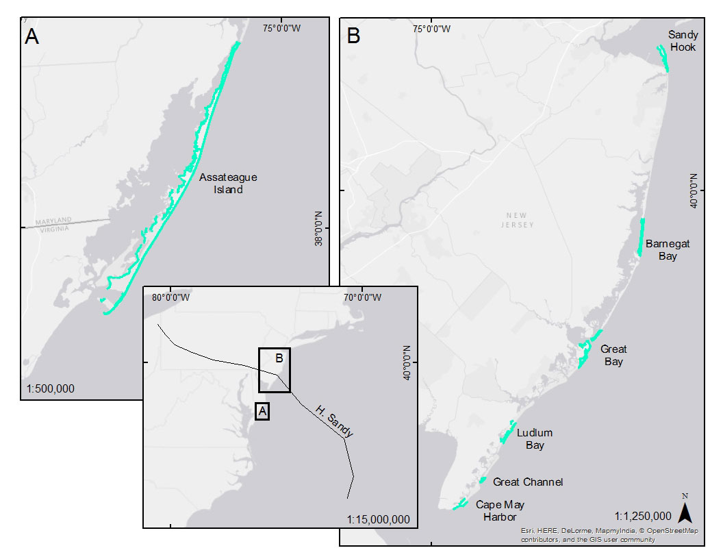
Figure 1. Location map.
Suggested Citation
Terrano, J.F. and Smith, K.E.L., 2016, Estuarine Shoreline and Barrier-Island Sandline Change Assessment: U.S. Geological Survey data release, https://doi.org/10.5066/F71Z42HN.