In accordance with SO #3423 - The Gulf of America and SO #3424 - Mount McKinley and Landmarks Honoring the Alaskan People, new USGS data releases specific to those named places will utilize the new name Gulf of America and the restored name Mount McKinley. Per USGS practice, historical data will retain the name of the geographic features as they were known at the time the data were originally released.
Data Release
Topobathymetric Lidar Survey of Breton and Gosier Islands, Louisiana, January 16 and 18, 2014
By Joseph F. Terrano, James G. Flocks, and Kathryn E.L. Smith
Summary
This dataset contains binary point-cloud data and a Digital Elevation Model (DEM), produced from remotely sensed, geographically referenced topobathymetric measurements encompassing the Breton Island and Gosier Islands, LA study area. The original area of interest was buffered by 100 meters to ensure complete coverage, resulting in approximately 75 square miles of lidar data.
The Breton Island Lidar project called for the planning, acquisition, processing, and derivative products of topobathymetric lidar data, collected at a nominal pulse spacing (NPS) of 0.5–0.45 meters (4–5 points/square meter). Lidar acquisition was prioritized to coincide with the lowest tide possible. Water clarity was also assessed and deemed acceptable prior to acquisition flights.The data, in meters, are projected to UTM Zone 16 North and referenced horizontally to the NAD83 (2011) datum and vertically to the NAVD88 (GEOID12A) datum. The classified point-cloud data were delivered in LAS v1.2 format and the merged DEM was converted to a GeoTIFF file. Each LAS file contains data in a 1-kilometer by 1-kilometer tile named according to the US National Grid conventions. The final product was a DEM for Breton Island along with a LAZ file for both Breton Island and Gosier Islands.
For further information regarding data collection and/or processing methods refer to USGS Open-File Report Analysis of Shoreline and Geomorphic Change for Breton Island, Louisiana from 1869 to 2014 (https://doi.org/10.3133/ofr20161039).
Data
| File Name and Description | Metadata (XML format) | Metadata (text format) | Download |
|---|---|---|---|
| Breton_Island.laz This data set contains classified point-cloud data in 1-kilometer by 1-kilometer tiles of Breton Island, LA named according to the US National Grid conventions that have been compressed to a LAZ format. |
Breton_Gosier_Islands_2014_ LAZ_Metadata.xml |
Breton_Gosier_Islands_2014_ LAZ_Metadata.txt |
Breton_Island.laz (372 MB) |
| Gosier_Islands.laz This data set contains classified point-cloud data in 1-kilometer by 1-kilometer tiles of Gosier Islands, LA named according to the US National Grid conventions that have been compressed to a LAZ format. |
Breton_Gosier_Islands_2014_ LAZ_Metadata.xml |
Breton_Gosier_Islands_2014_ LAZ_Metadata.txt |
Gosier_Islands.laz (242 MB) |
| DEM_2014.tif This data set contains a digital elevation model (DEM) of Breton Island, LA in a GeoTIFF format derived from the point-cloud data. |
Breton_Island_2014_DEM_ metadata.xml |
Breton_Island_2014_DEM_ metadata.txt |
DEM_2014.tif (5 MB) |
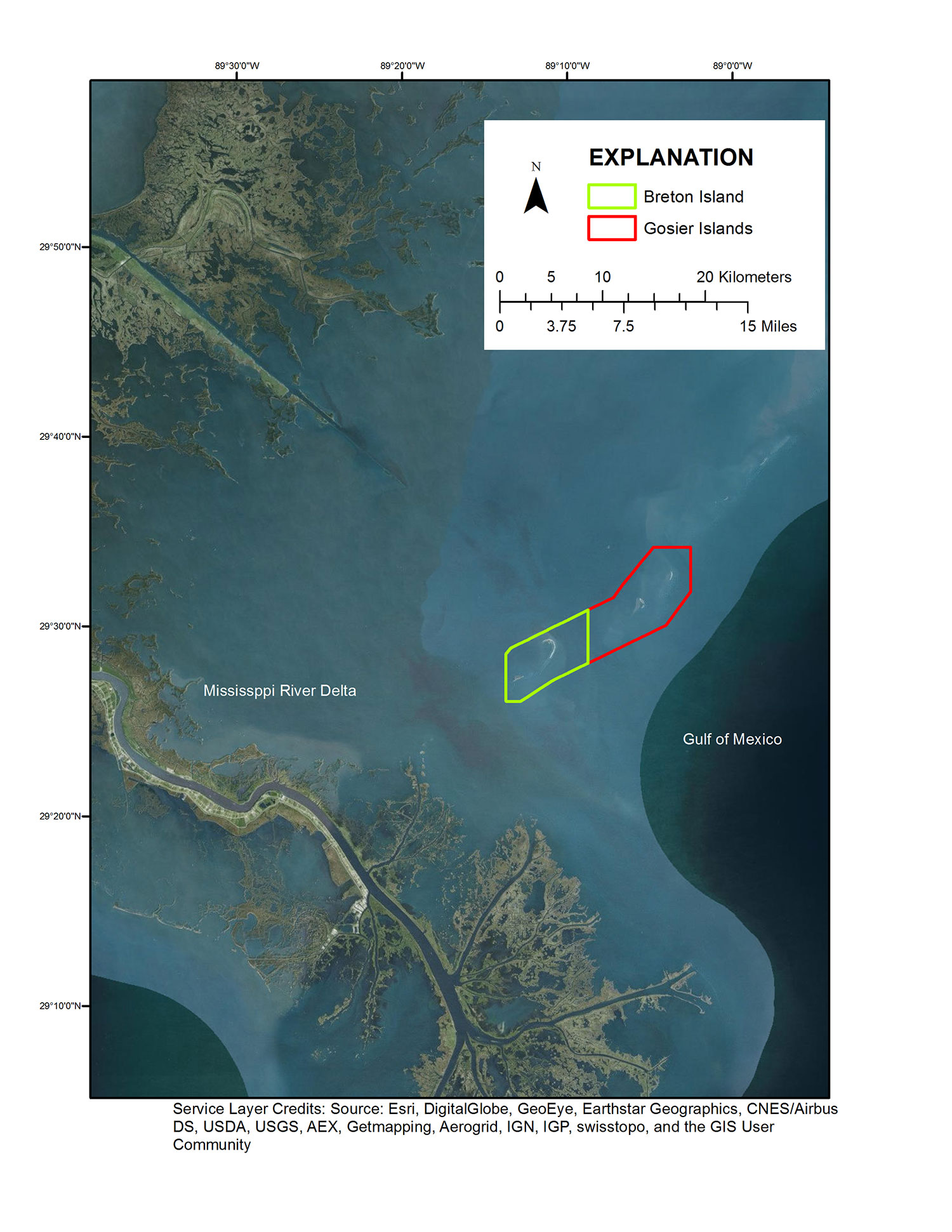
Figure 1. Location map.
Suggested Citation
Terrano, J.F., Flocks, J.G., and Smith, K.E.L., 2016, Topobathymetric Lidar Survey of Breton and Gosier Islands, Louisiana, January 16 and 18, 2014: U.S. Geological Survey data release, https://doi.org/10.5066/F70G3H6G.