In accordance with SO #3423 - The Gulf of America and SO #3424 - Mount McKinley and Landmarks Honoring the Alaskan People, new USGS data releases specific to those named places will utilize the new name Gulf of America and the restored name Mount McKinley. Per USGS practice, historical data will retain the name of the geographic features as they were known at the time the data were originally released.
Data Release
EAARL Coastal Topography–Dauphin Island, 2010
By Christine J. Kranenburg, Joseph W. Long, and David G. Zawada
USGS, St. Petersburg, Florida
Summary
These datasets, prepared by the U.S. Geological Survey St. Petersburg Coastal and Marine Science Center, provide lidar-derived first-surface and bare-earth topography for Dauphin Island, Alabama. Elevation measurements were acquired by the Experimental Advanced Airborne Research Lidar (EAARL) on July 24, 2010, one day before remnants from the dissipated Tropical Storm Bonnie came ashore.
Data
| File Name and Description | Metadata (XML format) | Metadata (text format) | Download File |
|---|---|---|---|
BONNIE2010_Dauphin_EAARLA_FS_n88g96.zip
|
BONNIE2010_Dauphin_ EAARLA_FS_n88g96_metadata.xml |
BONNIE2010_Dauphin_ EAARLA_FS_n88g96_metadata.txt |
BONNIE2010_Dauphin_ |
BONNIE2010_Dauphin_EAARLA_BE_n88g96.zip |
BONNIE2010_Dauphin_ EAARLA_BE_n88g96_metadata.xml |
BONNIE2010_Dauphin_ EAARLA_BE_n88g96_metadata.txt |
BONNIE2010_Dauphin_ EAARLA_BE_n88g96.zip (15.8 MB) |
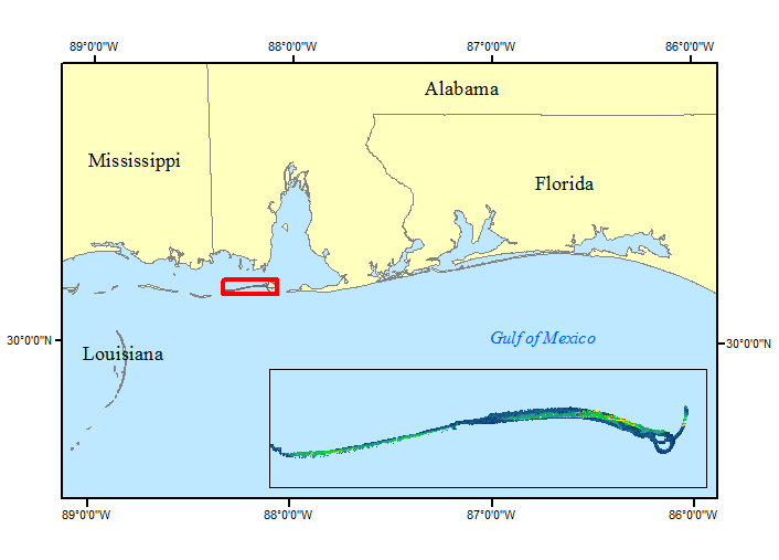
Figure 1. EAARL first-surface and bare-earth topography extent for Dauphin Island, AL data collected July 24, 2010.
Suggested Citation
Kranenburg, C.J., Long, J.W., and Zawada, D.G., 2016, EAARL Coastal Topography–Dauphin Island, 2010: U.S. Geological Survey data release, https://doi.org/10.5066/F74Q7S3M.