In accordance with SO #3423 - The Gulf of America and SO #3424 - Mount McKinley and Landmarks Honoring the Alaskan People, new USGS data releases specific to those named places will utilize the new name Gulf of America and the restored name Mount McKinley. Per USGS practice, historical data will retain the name of the geographic features as they were known at the time the data were originally released.
Data Release
Coastal Topography—Fire Island, New York, 07 May 2012
By Xan Fredericks, Cheryl J. Hapke, and Erika E. Lentz
USGS, St. Petersburg, Florida
Summary
Lidar-derived bare-earth topography Digital Elevation Model (DEM) mosaic and classified point-cloud datasets for Fire Island, New York, were produced from remotely sensed, geographically referenced elevation measurements collected on May 7, 2012.
Data
| File Name and Description | Metadata (XML format) | Metadata (text format) | Download File |
|---|---|---|---|
| FIIS2012_BE_z18_n88g09_mosaic.zip Lidar-derived bare-earth topography Digital Elevation Model (DEM) mosaic for Fire Island, New York (.tif) |
FIIS2012_BE_z18_n88g09_ mosaic_metadata.xml |
FIIS2012_BE_z18_n88g09_ mosaic_metadata.txt |
FIIS2012_BE_z18_n88g09_mosaic.zip (392.8 MB) |
| FIIS2012_BE_z18_n88g09_classified.zip Lidar-derived classified point-cloud dataset for Fire Island, New York (.laz) |
FIIS2012_BE_z18_n88g09_ classified_metadata.xml |
FIIS2012_BE_z18_n88g09_ classified_metadata.txt |
FIIS2012_BE_z18_n88g09_classified.zip (1.2 GB) |
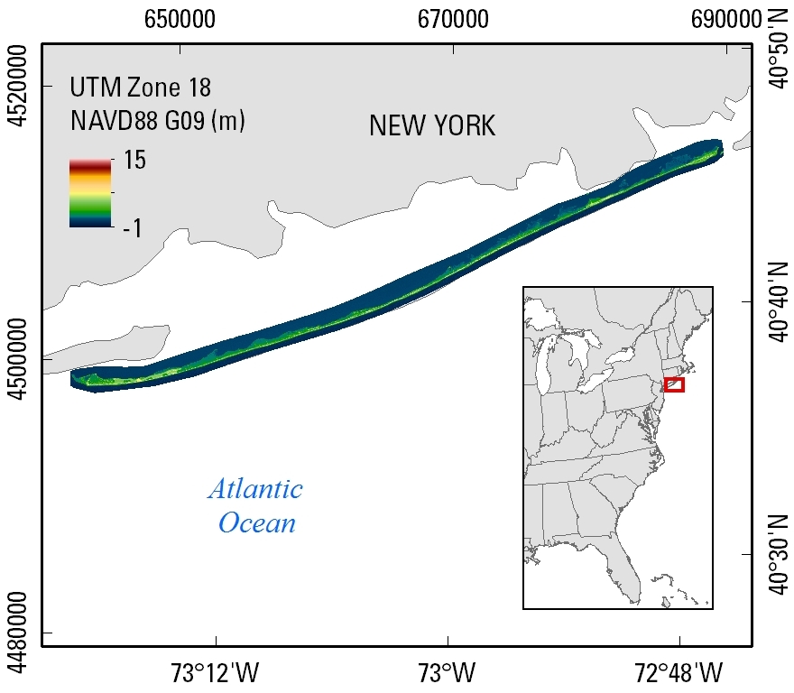
Figure 1. Bare-earth topography DEM extent on Fire Island, New York; data were collected May 7, 2012.
Suggested Citation
Fredericks, Xan, Hapke, C.J., and Lentz, E.E., 2016, Coastal Topography—Fire Island, New York, 07 May 2012: U.S. Geological Survey data release, https://doi.org/10.5066/F7513WBW.