In accordance with SO #3423 - The Gulf of America and SO #3424 - Mount McKinley and Landmarks Honoring the Alaskan People, new USGS data releases specific to those named places will utilize the new name Gulf of America and the restored name Mount McKinley. Per USGS practice, historical data will retain the name of the geographic features as they were known at the time the data were originally released.
Data Release
EAARL Coastal Topography—Cape Hatteras, North Carolina, Pre- and Post-Hurricane Isabel, 2003
By Xan Fredericks, Christine J. Kranenburg, and David B. Nagle
USGS, St. Petersburg, Florida
Summary
These XYZ datasets provide lidar-derived bare-earth topography for Cape Hatteras, North Carolina. Elevation measurements were acquired pre-Hurricane Isabel on September 16 and post-Hurricane Isabel on September 21, 2003 by the first-generation Experimental Advanced Airborne Research Lidar (EAARL), in cooperation with the National Aeronautics and Space Administration (NASA).
Data
| File Name and Description | Metadata (XML format) | Metadata (text format) | Download File |
|---|---|---|---|
| CAHA2003_PreIsabel_EAARLA_BE_n88g96.zip Lidar-derived bare-earth topography XYZ dataset for Cape Hatteras, North Carolina, collected pre-Hurricane Isabel (.xyz) |
CAHA2003_PreIsabel_EAARLA_ BE_n88g96_metadata.xml |
CAHA2003_PreIsabel_EAARLA_ BE_n88g96_metadata.txt |
CAHA2003_PreIsabel_EAARLA_ BE_n88g96.zip (7 MB) |
| CAHA2003_PostIsabel_EAARLA_BE_n88g96.zip Lidar-derived bare-earth topography XYZ dataset for Cape Hatteras, North Carolina, collected post-Hurricane Isabel (.xyz) |
CAHA2003_PostIsabel_EAARLA_ BE_n88g96_metadata.xml |
CAHA2003_PostIsabel_EAARLA_ BE_n88g96_metadata.txt |
CAHA2003_PostIsabel_EAARLA_ BE_n88g96.zip (12 MB) |
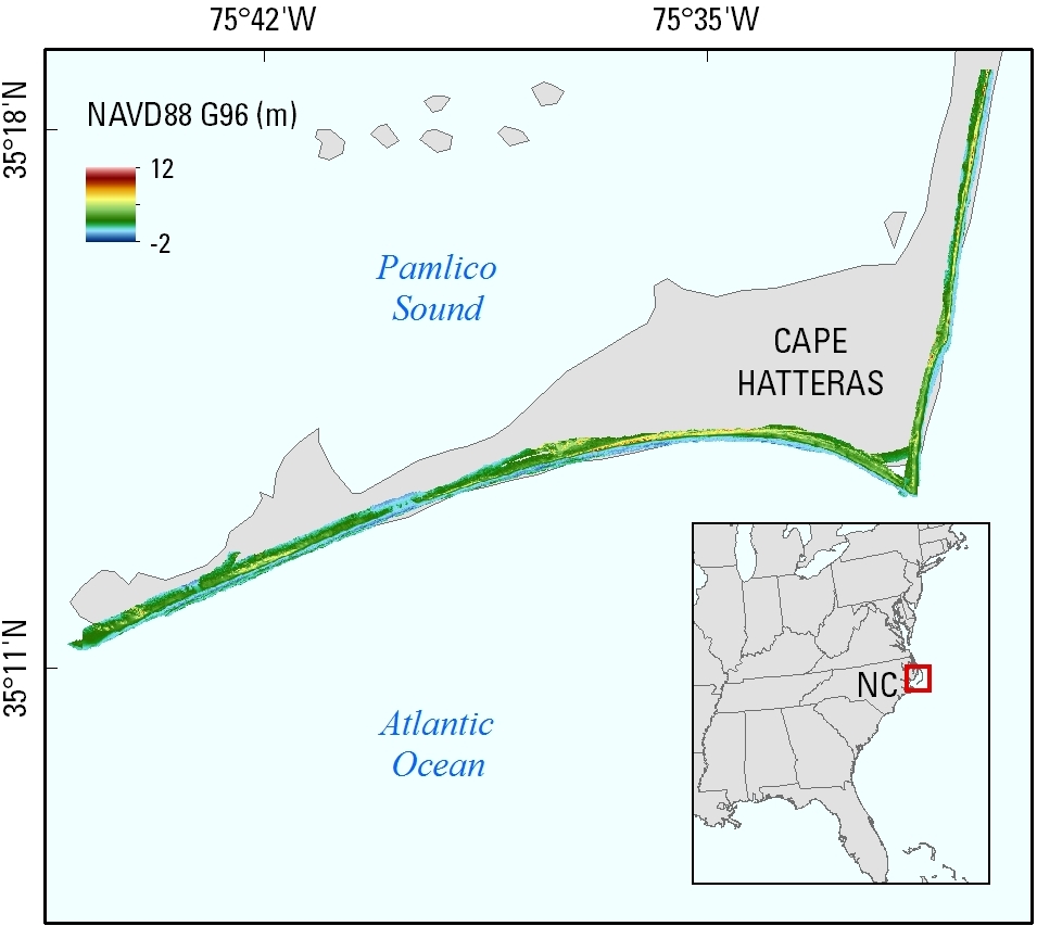
Figure 1. Data extent on Cape Hatteras, North Carolina; data were collected September 16 and 21, 2003.
Suggested Citation
Fredericks, Xan, Kranenburg, C.J., and Nagle, D.B., 2017, EAARL Coastal Topography—Cape Hatteras, North Carolina, Pre- and Post-Hurricane Isabel, 2003: U.S. Geological Survey data release, https://doi.org/10.5066/F76W9879.