In accordance with SO #3423 - The Gulf of America and SO #3424 - Mount McKinley and Landmarks Honoring the Alaskan People, new USGS data releases specific to those named places will utilize the new name Gulf of America and the restored name Mount McKinley. Per USGS practice, historical data will retain the name of the geographic features as they were known at the time the data were originally released.
Data Release
Distribution of Benthic Habitats at Crocker Reef, Florida, 2014
By David G. Zawada, Kristin H. Netchy, and Jessica P. Resnick
USGS, St. Petersburg, Florida
Summary
The distribution of benthic habitats for a 1-kilometer (km) x 1-km area around Crocker Reef in the Florida Keys is based upon underwater digital images of the seafloor collected June 24–25, 2014. The imagery was collected using the U.S. Geological Survey shallow Along-Track Reef Imaging System (sATRIS), a boat-based, pole-mounted sensor package for mapping shallow-water benthic environments. The polygons contained in this shapefile represent the four general habitat types found at Crocker Reef: hardbottom, rubble, sand, and seagrass. The data were collected under Florida Keys National Marine Sanctuary permit FKNMS-2013-097.
For further information regarding data collection methods refer to:
Lidz, B.H., and Zawada, D.Z., 2013, Possible return of Acropora cervicornis at Pulaski Shoal, Dry Tortugas National Park, Florida: Journal of Coastal Research v. 29, no. 2, p. 256–271, https://doi.org/10.2112/JCOASTRES-D-12-00078.1.
The shallow ATRIS imagery is available in USGS data release:
Zawada, D.G., Thornton, L.E., Thompson, P.R., and Resnick, J.P., 2016, ATRIS Seafloor Images—Crocker Reef, Florida, 2014: U.S. Geological Survey data release, https://doi.org/10.5066/F7SF2T9Z.
Data
| File Name and Description | Metadata (XML format) | Metadata (text format) | Download File |
|---|---|---|---|
| CRKR2014_HABITAT.zip Habitat map shapefile for Crocker Reef, Florida (.shp) |
CRKR2014_HABITAT_metadata.xml | CRKR2014_HABITAT_metadata.txt | CRKR2014_HABITAT.zip (129 KB) |
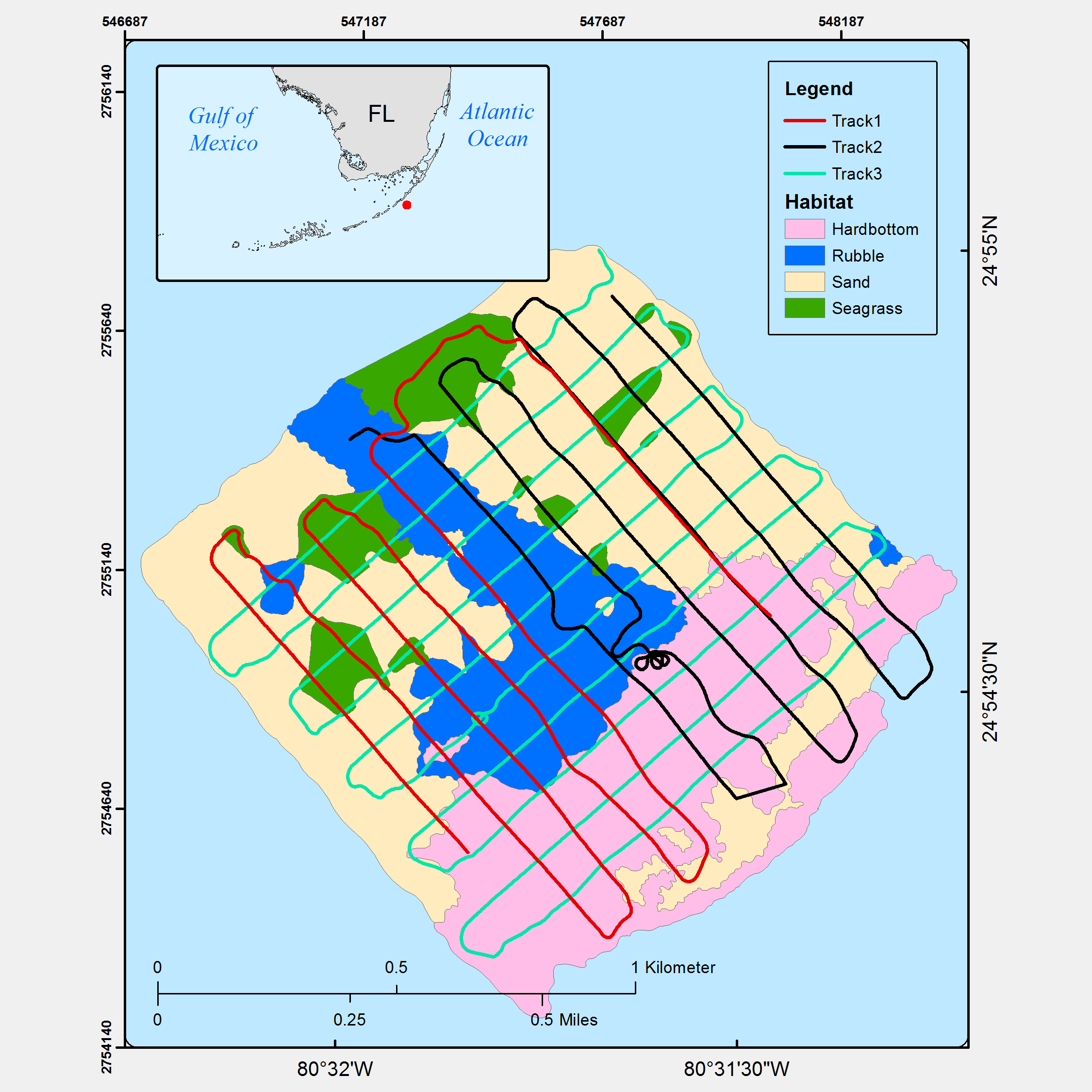
Figure 1. Plot of the polygons contained in this data release representing the distribution of habitats found at Crocker Reef, Florida. Colored lines indicate the ATRIS track lines followed during image acquisition.
Suggested Citation
Zawada, D.G., Netchy, K.H., and Resnick, J.P., 2016, Distribution of Benthic Habitats at Crocker Reef, Florida, 2014: U.S. Geological Survey data release, https://doi.org/10.5066/F77942T0.