In accordance with SO #3423 - The Gulf of America and SO #3424 - Mount McKinley and Landmarks Honoring the Alaskan People, new USGS data releases specific to those named places will utilize the new name Gulf of America and the restored name Mount McKinley. Per USGS practice, historical data will retain the name of the geographic features as they were known at the time the data were originally released.
Data Release
Ground-Based Lidar Beach Topography of Fire Island, New York, April 2014
By Owen Brenner, Cheryl J. Hapke, Nicholas J. Spore, Katherine L. Brodie, and Jesse E. McNinch
USGS, St. Petersburg, Florida
Summary
The U.S. Geological Survey St. Petersburg Coastal and Marine Science Center and the U.S. Army Corps of Engineers Field Research Facility of Duck, NC collaborated to gather alongshore ground-based lidar beach topography at Fire Island, NY. This high-resolution elevation dataset was collected on April 1, 2014, and is part of the USGS's ongoing beach monitoring effort under Hurricane Sandy Supplemental Project GS2-2B. This USGS Data Release includes the resulting processed elevation point data (xyz) and an interpolated digital elevation model (DEM). For further information regarding data collection and/or processing methods refer to previously published USGS Data Series (https://pubs.usgs.gov/ds/0921/ds921_data-aquisition.html).
Data
| File Name and Description | Metadata (XML format) | Metadata (text format) | Download |
|---|---|---|---|
| 20140401_CLARIS_DEM.zip Interpolated digital elevation model (DEM) |
20140401_CLARIS_metadata_dem.xml |
20140401_CLARIS_metadata_dem.txt |
20140401_CLARIS_DEM.zip (11 MB) |
| 20140401_CLARIS_XYZ.txt processed elevation point data (xyz) |
20140401_CLARIS_metadata_xyz.xml |
20140401_CLARIS_metadata_xyz.txt |
20140401_CLARIS_XYZ.zip (77 MB) |
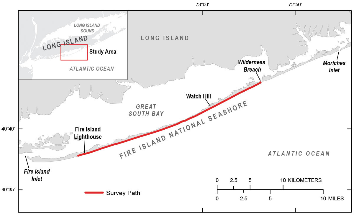
Figure 1. April 1, 2014 ground-based lidar beach survey extends from the western boundary of Fire Island National Seashore to the Wilderness Breach.
Suggested Citation
Brenner, O.T., Hapke, C.J., Spore, N.J., Brodie, K.L., and McNinch, J.E., 2015, Ground-Based Lidar Beach Topography of Fire Island, New York, April 2014: U.S. Geological Survey data release, https://doi.org/10.5066/F77H1GNN.