In accordance with SO #3423 - The Gulf of America and SO #3424 - Mount McKinley and Landmarks Honoring the Alaskan People, new USGS data releases specific to those named places will utilize the new name Gulf of America and the restored name Mount McKinley. Per USGS practice, historical data will retain the name of the geographic features as they were known at the time the data were originally released.
Data Release
Time Series of Autonomous Carbonate System Parameter Measurements in Tampa Bay, Florida, USA
By Kimberly K. Yates, Christopher S. Moore, and Nathan H. Goldstein
USGS, St. Petersburg, Florida
Summary
This data set contains time series measurements of carbonate system parameters including water temperature (°C), conductivity (siemens), pressure (dbars), salinity, pHT (pH on the total scale), carbon dioxide (ppm), dissolved oxygen (micromol/L), and photosynthetically active radiation (microEinsteins). These data were collected in Tampa Bay, Florida by the U.S. Geological Survey (USGS) St. Petersburg Coastal and Marine Science Center using an autonomous instrument package called the Ocean Carbon System (OCS). The OCS consists of five sensors integrated using a Satlantic Stor-X data logger including a Seabird 16plus CTD, a Satlantic SeaFET pH sensor, a Pro-Oceanus CO2-Pro sensor, an Aanderaa oxygen optode, and a Wetlabs Eco-PAR sensor. Each parameter was measured hourly over multiple twenty-four hour time periods, ranging from days to weeks.
Data
| File Name and Description | Metadata (XML format) | Metadata (text format) | Download File |
|---|---|---|---|
| Tampa-Bay-OCS-Data-May-2015.zip Contains measured parameters from an autonomous ocean carbon system (.csv) |
Tampa-Bay-OCS-metadata.xml | Tampa-Bay-OCS-metadata.txt | Tampa-Bay-OCS-May-2015.zip (23 KB) |
| Tampa-Bay-OCS-Data-Jan-2016.zip Contains measured parameters from an autonomous ocean carbon system (.csv) |
same as above | same as above | Tampa-Bay-OCS-Jan-2016.zip (23 KB) |
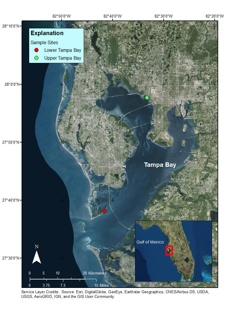
Figure 1. Location of OCS data collection in Upper Tampa Bay and Lower Tampa Bay. Upper Bay site (green circle) located at 82°33'15.12"W, 27°57'40.5"N. Lower Bay site (red circle) located at 82°41'36.96"W, 27°38'9.996"N.
Suggested Citation
Yates, K.K., Moore, C.S., and Goldstein, N.H., 2017, Time series of carbonate system parameters in Tampa Bay, Florida, USA: U.S. Geological Survey data release, https://doi.org/10.5066/F77H1GTW.