In accordance with SO #3423 - The Gulf of America and SO #3424 - Mount McKinley and Landmarks Honoring the Alaskan People, new USGS data releases specific to those named places will utilize the new name Gulf of America and the restored name Mount McKinley. Per USGS practice, historical data will retain the name of the geographic features as they were known at the time the data were originally released.
Data Release
Shorelines Derived From Continuous Video-Imagery at the NASA-Kennedy Space Center, Florida From August 2011 to July 2012
By Breanna N. Williams,1 Heather A. Schreppel,2 and Nathaniel G. Plant2
1 Cherokee Nation System Solutions
2 U.S. Geological Survey, St. Petersburg Coastal and Marine Science Center
Summary
In 2010, a video camera was installed near the northern boundary of the National Aeronautics and Space Administration-Kennedy Space Center (NASA-KSC) property along the Atlantic coast of Florida. A region extending 1 kilometer (km) to the south of the camera was established as the region of interest for the video image observations. During every daylight hour of camera operation from August 8, 2011 to July 24, 2012, a time exposure (timex) image product was created by averaging pixel color intensity for all frames collected during a 10-minute video at 2 frames per second (hertz, Hz). One timex image per day was used for analysis. The timex selected for each day was the product that was created when the tide level was closest to the Mean High Water (MHW) at the study site. Based on observed water levels from a nearby National Oceanic and Atmospheric Administration (NOAA) station, the MHW was determined to be 0.23 meters (m). The shoreline was manually identified as the wet-dry line within the region of interest of each available timex product. However, timex products were not available for about half of this timeframe due to camera malfunctions, adverse weather conditions (for example, fog), and/or a lack of daylight during the timing of MHW. Please carefully review the metadata for more information. This dataset is referenced in an associated publication that analyzed shoreline variability over daily to decadal timescales at NASA-KSC to quantify and compare variability and associated drivers at each timescale. For more information, refer to Conlin and others (2019).
Conlin, M.P., Adams, P.N., Plant, N.G., Jaeger, J.M., and Mackenzie, R., 2019, Daily to decadal variability of beach morphology at NASA-Kennedy Space Center—storm influences across timescales, in Wang, P., Rosati, J.D., and Vallee, M., eds., Coastal sediments 2019—Proceedings of the 9th International Conference on Coastal Sediments, Tampa-St. Petersburg, Florida, U.S.A., 27–31 May 2019: [New Jersey], World Scientific Publishing Company, p. 2268–2281, https://doi.org/10.1142/9789811204487_0194.
Data
| File Name and Description | Metadata (XML format) | Metadata (text format) | Download File |
|---|---|---|---|
| NASA-KSC_shorelines.zip Comma-separated values text file of the shorelines derived from the continuous video-imagery at NASA-KSC (.txt) |
NASA-KSC_shorelines_metadata.xml | NASA-KSC_shorelines_metadata.txt | NASA-KSC_shorelines.zip (459 KB) |
| Supplemental information | |||
| SupplementalFiles.zip Includes camera setup photographs and sample timex image products (.jpg, .jgw, and .xml) |
Not applicable | Not applicable | SupplementalFiles.zip (664 KB) |
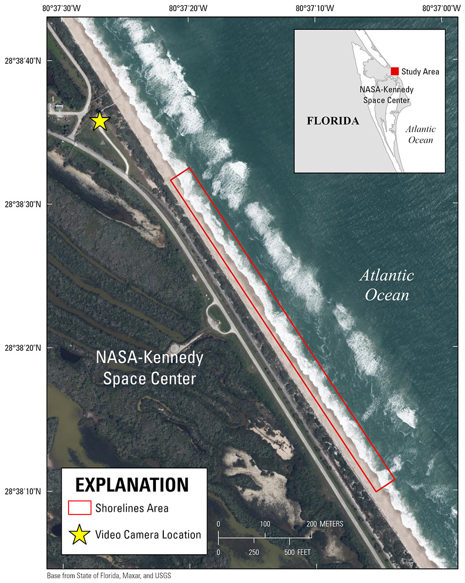
Figure 1. Location of the video camera (yellow star) and the study area of the shorelines (red box) derived from continuous video-imagery at NASA-Kennedy Space Center on the Atlantic coast of Florida.
Suggested Citation
Williams, B.N., Schreppel, H.A., and Plant, N.G., 2021, Shorelines derived from continuous-video imagery at the NASA-Kennedy Space Center, Florida from August 2011 to July 2012: U.S. Geological Survey data release, https://doi.org/10.5066/F78050QD.