In accordance with SO #3423 - The Gulf of America and SO #3424 - Mount McKinley and Landmarks Honoring the Alaskan People, new USGS data releases specific to those named places will utilize the new name Gulf of America and the restored name Mount McKinley. Per USGS practice, historical data will retain the name of the geographic features as they were known at the time the data were originally released.
Data Release
Terrestrial-Based Lidar Beach Topography of Fire Island, New York, May 2015
By Owen Brenner, Cheryl J. Hapke, Kathryn G. Lee, and Dustin R. Kimbrow
USGS, St. Petersburg, Florida
Summary
The U.S. Geological Survey (USGS) St. Petersburg Coastal and Marine Science Center (SPCMSC) and the USGS Lower Mississippi-Gulf Water Science Center (LMG WSC) in Montgomery, Alabama, collected terrestrial-based light detection and ranging (T-lidar) elevation data at Fire Island, New York. The data were collected on May 18, 2015 as part of the ongoing beach monitoring within Hurricane Sandy Supplemental Project GS2-2B, and will be used to document and assess the morphological storm response and post-storm beach recovery. The survey extended along 35 kilometers of the Fire Island National Seashore, from the eastern boundary of Robert Moses State Park to the western boundary of Smith Point County Park. This USGS Data Release includes the resulting processed elevation point data (xyz) and an interpolated digital elevation model (DEM). For further information regarding data collection and/or processing methods, refer to previously published USGS Data Series 980 (https://doi.org/10.3133/ds980).
Previous Fire Island lidar beach elevation datasets:
| Survey Date | Online Link |
|---|---|
| April 10, 2013 | https://doi.org/10.3133/ds921 |
| April 1, 2014 | https://doi.org/10.5066/F77H1GNN |
| June 11, 2014 | https://doi.org/10.3133/ds980 |
Data
| File Name and Description | Metadata (XML format) | Metadata (text format) | Download File |
|---|---|---|---|
| 20150518_FI_USGS_DEM.zip Interpolated digital elevation model (DEM) |
20150518_FI_USGS_ DEM_metadata.xml |
20150518_FI_USGS_ DEM_metadata.txt |
20150518_FI_USGS_ DEM.zip (6 MB) |
| 20150518_FI_USGS_XYZ.txt Processed elevation point data (xyz) |
20150518_FI_USGS_ XYZ_metadata.xml |
20150518_FI_USGS_ XYZ_metadata.txt |
20150518_FI_USGS_ XYZ.zip (5 MB) |
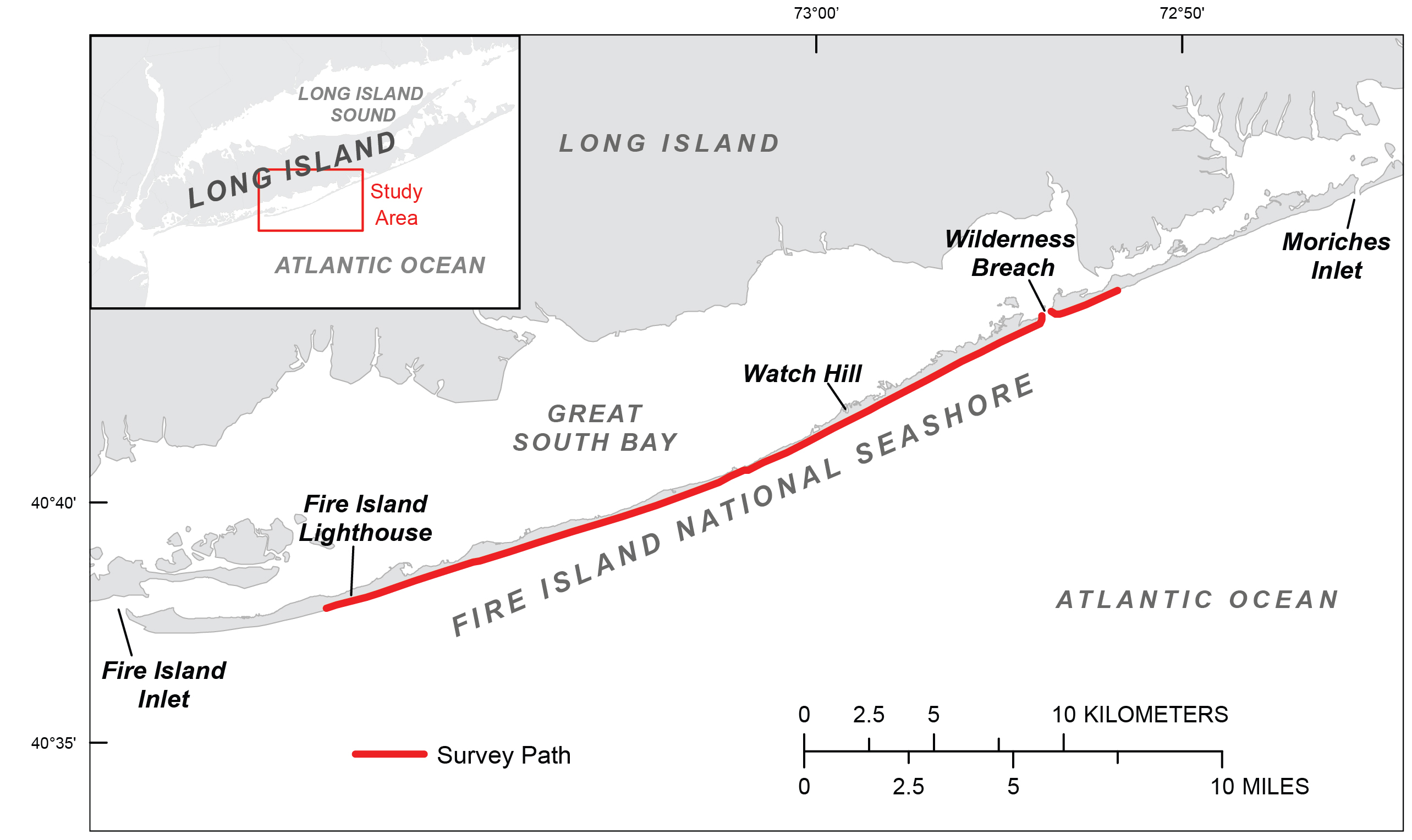
Figure 1. The May 18, 2015, terrestrial lidar beach survey includes 35 kilometers of the Fire Island National Seashore at Fire Island, New York.
Suggested Citation
Brenner, O.T., Hapke, C.J., Lee, K.G., and Kimbrow, D.R., 2016, Terrestrial-Based Lidar Beach Topography of Fire Island, New York, May 2015: U.S. Geological Survey data release, https://doi.org/10.5066/F7862DKH.