In accordance with SO #3423 - The Gulf of America and SO #3424 - Mount McKinley and Landmarks Honoring the Alaskan People, new USGS data releases specific to those named places will utilize the new name Gulf of America and the restored name Mount McKinley. Per USGS practice, historical data will retain the name of the geographic features as they were known at the time the data were originally released.
Data Release
Coastal Single-Beam Bathymetry Data Collected in 2017 from the Chenier Plain, Louisiana
By Chelsea A. Stalk, 1 James G. Flocks, 2 Julie C. Bernier, 2 Nancy T. DeWitt, 2 Joseph J. Fredericks, 2 Kyle W. Kelso, 2 Andrew S. Farmer, 1 Thomas M. Tuten, 1 and Hunter S. Wilcox 1
1 Cherokee Nation Technologies
2 U.S Geological Survey St. Petersburg Coastal and Marine Science Center
Summary
As part of the Louisiana Coastal Protection and Restoration Authority’s Barrier Island Comprehensive Monitoring Program (BICM), scientists from the U.S. Geological Survey (USGS) St. Petersburg Coastal and Marine Science Center conducted a nearshore single-beam bathymetry survey along the Chenier Plain, Louisiana, from Marsh Island to Sabine Pass. The goal of the BICM program is to provide long-term data on Louisiana’s coastline and to use this data to plan, design, evaluate, and maintain current and future barrier island restoration projects. The data described in this report will provide baseline bathymetric information for future research investigating island evolution, sediment transport, and recent and long term geomorphic change, and will support modeling of future changes in response to restoration and storm impacts. Over 3,300 line kilometers of single-beam data were acquired during two field missions, USGS Field Activity numbers 2017-323-FA, June 2–14, and 2017-324-FA, July 8–16, 2017, aboard 4 separate survey vessels. The final x,y,z data are provided in the native format of WGS84 G1150 (ITRF00), values ranging from -26.62 m to -69.94 m Ellipsoid height, as well as NAD83 NAVD88 Geoid 12A, with values ranging from 0.00 to -42.19 m. Supplemental data products include 200 m cell-size interpolated bathymetry grids, trackline maps, Field Activity Collection System logs, x,y,z point data files and formal Federal Geographic Data Committee (FGDC) metadata.
Data
| File Name and Description | Metadata (XML format) | Metadata (text format) | Download File |
|---|---|---|---|
| Chenier_Plain_2017_SBB_XYZ.zip Single-beam x,y,z data in both WGS84 ITRF00 (G1150) and NAD83 NAVD88 Geoid 12A (.txt); please note large file size impacts load rate |
Chenier_Plain_2017_SBB_XYZ_ metadata.xml |
Chenier_Plain_2017_SBB_XYZ_ metadata.txt |
Chenier_Plain_2017_SBB_XYZ.zip (555 MB) |
| Chenier_Plain_2017_SBB_ITRF00_Tracklines.zip Single-beam tracklines in WGS84 ITRF00 (G1150) (.shp) |
Chenier_Plain_2017_SBB_ITRF00_ Trackline_metadata.xml |
Chenier_Plain_2017_SBB_ITRF00_ Trackline_metadata.txt |
Chenier_Plain_2017_SBB_ITRF00_ Tracklines.zip (108 MB) |
| Chenier_Plain_2017_SBB_200m_DEM.zip Bathymetry Digital Elevation Model (DEM) 200m cell size in both WGS84 ITRF00 (G1150) and NAD83 NAVD88 Geoid 12A (.tif) |
Chenier_Plain_2017_SBB_ 200m_DEM_metadata.xml |
Chenier_Plain_2017_SBB_ 200m_DEM_metadata.txt |
Chenier_Plain_2017_SBB_200m_DEM.zip (254 KB) |
| Supplemental Information | |||
| 2017-323-FA_FACS.zip Field Activity Collection System (FACS) logs (.pdf) |
Not applicable | Not applicable | 2017-323-FA_FACS.zip (848 KB) |
| 2017-324-FA_FACS.zip Field Activity Collection System (FACS) logs (.pdf) |
Not applicable | Not applicable | 2017-324-FA_FACS.zip (376 KB) |
| Chenier_Plain_2017_SBB_DEM_Image.zip Images of the 200m WGS84 (G1150) DEM and 200m NAD83 NAVD88 Geoid 12A DEM (.jpg) |
Not applicable | Not applicable | Chenier_Plain_2017_SBB_DEM_Image.zip (933 KB) |
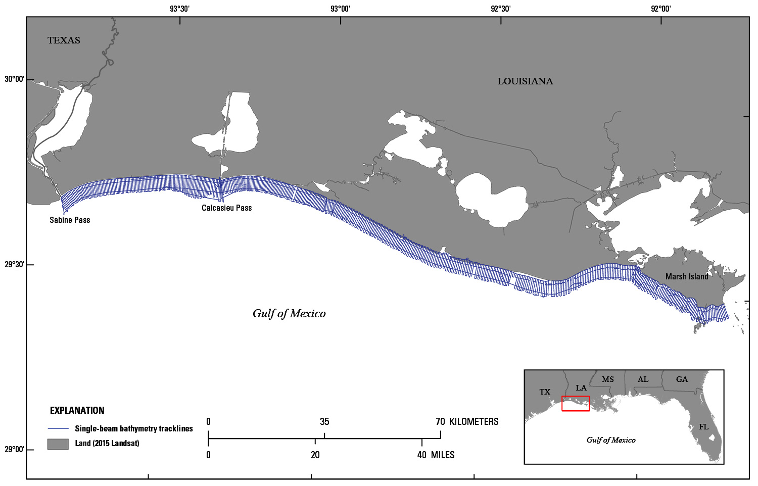
Figure 1. Trackline overview map for the 2017 Barrier Island Comprehensive Monitoring Program single-beam bathymetry survey along the Chenier Plain, Louisiana. Base map modified from USGS 1:100,000-scale Digital Line Graph (DLG) data.
Suggested Citation
Stalk, C.A., Flocks, J.G., Bernier, J.C., DeWitt, N.T., Fredericks, J.J., Kelso, K.W., Farmer, A.S., Tuten, T.M., and Wilcox, H.S., 2018, Coastal single-beam bathymetry data collected in 2017 from the Chenier Plain, Louisiana: U.S. Geological Survey data release, https://doi.org/10.5066/F7CV4GZH.