In accordance with SO #3423 - The Gulf of America and SO #3424 - Mount McKinley and Landmarks Honoring the Alaskan People, new USGS data releases specific to those named places will utilize the new name Gulf of America and the restored name Mount McKinley. Per USGS practice, historical data will retain the name of the geographic features as they were known at the time the data were originally released.
Data Release
Shallow ATRIS (sATRIS) Images—Dry Tortugas National Park, Florida, 2009
By David G. Zawada and Jessica P. Resnick
USGS, St. Petersburg, Florida
Summary
Underwater digital images, single-beam bathymetry, and global positioning system (GPS) data were collected June 13–14, 2009 at Pulaski Shoal within Dry Tortugas National Park, FL, USA. A total of 195,406 images of the seafloor and water column were collected along pre-defined transect lines and organized into 3 sets: track1, track2, and track3. This data release contains a subset of those images (32,135 images), all of which were used for benthic habitat classification, and contain GPS data. The data were collected using the U.S. Geological Survey (USGS) shallow Along-Track Reef-Imaging System (sATRIS), a boat-based, pole-mounted sensor package for mapping shallow-water benthic environments. Two other implementations exist: A towed system called Deep ATRIS and a profiling system called Drift ATRIS. All three ATRIS implementations incorporate a digital still camera and an acoustic depth sounder.
For further information regarding data collection methods refer to:
Lidz, B.H., and Zawada, D.Z., 2013, Possible return of Acropora cervicornis at Pulaski Shoal, Dry Tortugas National Park, Florida: Journal of Coastal Research v. 29, no. 2, p. 256–271, https://doi.org/10.2112/JCOASTRES-D-12-00078.1.
Data
| File Name and Description | Metadata (XML format) | Metadata (text format) | Download File |
|---|---|---|---|
| DRTO2009_ATRIS_track1.zip JPEG images with EXIF headers collected using shallow ATRIS from Dry Tortugas, Florida for track 1 (.jpg) |
DRTO2009_ATRIS_metadata.xml | DRTO2009_ATRIS_metadata.txt | DRTO2009_ATRIS_track1.zip (3.6 GB) |
| DRTO2009_ATRIS_track2.zip JPEG images with EXIF headers collected using shallow ATRIS from Dry Tortugas, Florida for track 2 (.jpg) |
Same as above | Same as above | DRTO2009_ATRIS_track2.zip (798 MB) |
| DRTO2009_ATRIS_track3.zip JPEG images with EXIF headers collected using shallow ATRIS from Dry Tortugas, Florida for track 3 (.jpg) |
Same as above | Same as above | DRTO2009_ATRIS_track3.zip (1.47 GB) |
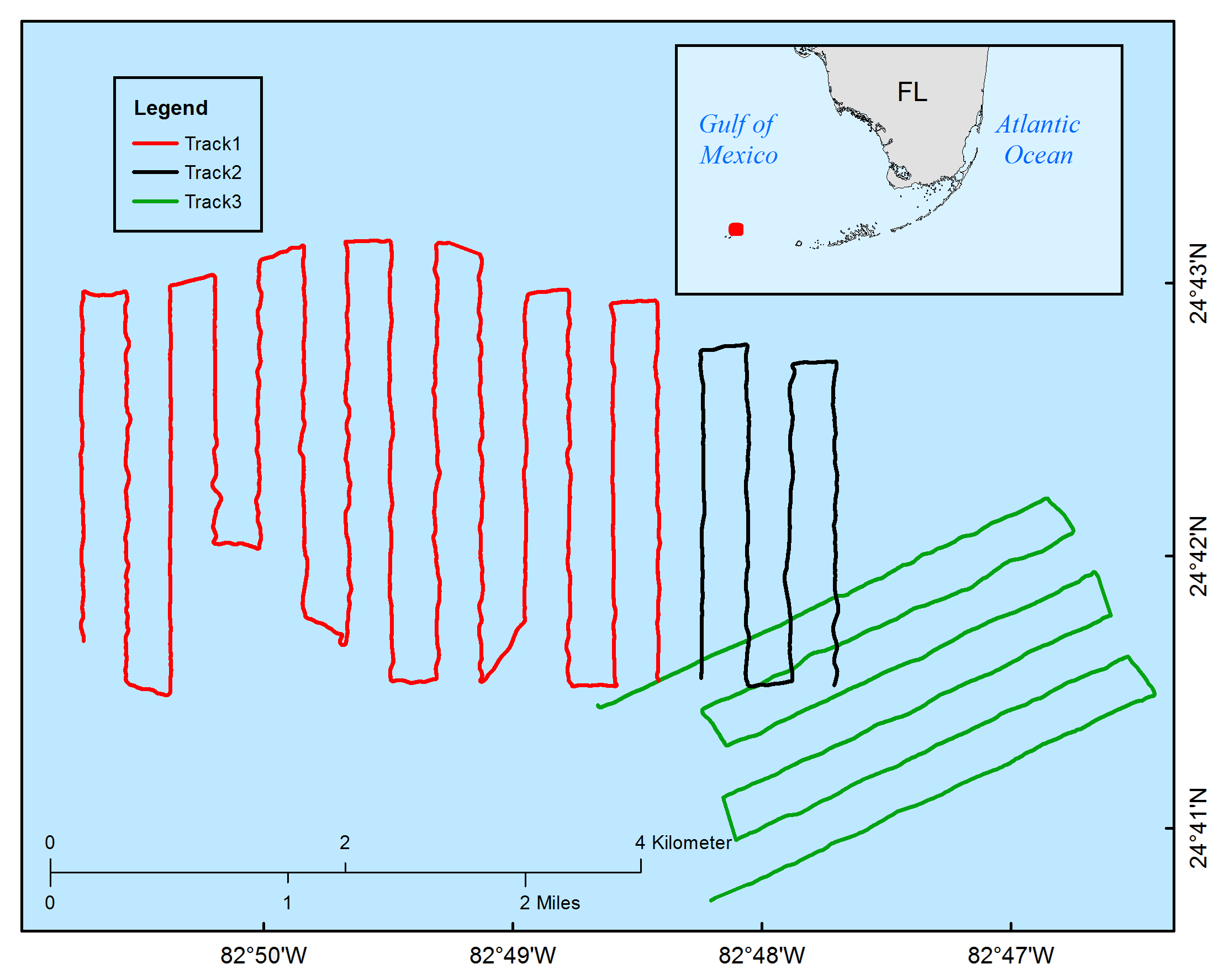
Figure 1. ATRIS image extent for Dry Tortugas, Florida; data were collected in June 2009.
Suggested Citation
Zawada, D.G. and Resnick, J.P., 2018, Shallow ATRIS (sATRIS) images—Dry Tortugas National Park, Florida, 2009: U.S. Geological Survey data release, https://doi.org/10.5066/F7CZ35CT.