In accordance with SO #3423 - The Gulf of America and SO #3424 - Mount McKinley and Landmarks Honoring the Alaskan People, new USGS data releases specific to those named places will utilize the new name Gulf of America and the restored name Mount McKinley. Per USGS practice, historical data will retain the name of the geographic features as they were known at the time the data were originally released.
Data Release
Coastal Topography—Upper Florida Keys Reef Tract, Florida, 26-30 June 2016
By Xan Fredericks, Christine J. Kranenburg, and David G. Zawada
USGS, St. Petersburg, Florida
Summary
Lidar-derived seamless (bare earth and submerged) topography Digital Elevation Model (DEM) mosaic and classified point-cloud datasets of a portion of the upper Florida Keys reef tract were produced from remotely sensed, geographically referenced elevation measurements collected June 26–30, 2016.
Data
| File Name and Description | Metadata (XML format) | Metadata (text format) | Download File |
|---|---|---|---|
| KEYS2016_SM_z17_n88g12B_mosaic.zip Lidar-derived seamless topography DEM mosaic of the upper Florida Keys reef tract (.tif) |
KEYS2016_SM_z17_n88g12B_ mosaic_metadata.xml |
KEYS2016_SM_z17_n88g12B_mosaic_ metadata.txt |
KEYS2016_SM_z17_n88g12B_ mosaic.zip (950 MB) |
| KEYS2016_SM_z17_n88g12B_classified.zip Lidar-derived classified point-cloud dataset of the upper Florida Keys reef tract. Please note large file size impacts load rate (.laz) |
KEYS2016_SM_z17_n88g12B_ classified_metadata.xml |
KEYS2016_SM_z17_n88g12B_ classified_metadata.txt |
KEYS2016_SM_z17_n88g12B_ classified.zip (13.1 GB) |
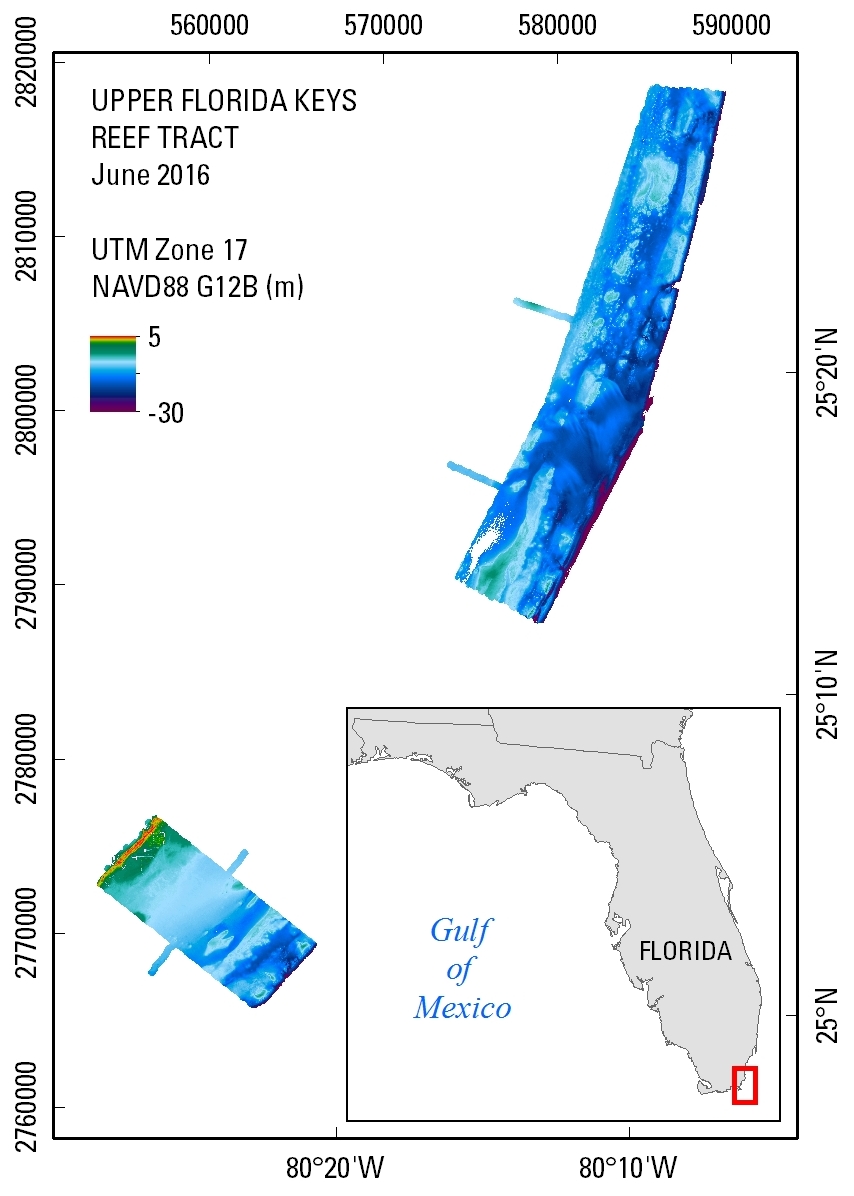
Figure 1. Seamless (bare earth and submerged) topography DEM extent of the upper Florida Keys reef tract; data were collected June 26–30, 2016.
Suggested Citation
Fredericks, Xan, Kranenburg, C.J., and Zawada, D.G., 2017, Coastal Topography—Upper Florida Keys Reef Tract, Florida, 26-30 June 2016: U.S. Geological Survey data release, https://doi.org/10.5066/F7QZ28XZ.