In accordance with SO #3423 - The Gulf of America and SO #3424 - Mount McKinley and Landmarks Honoring the Alaskan People, new USGS data releases specific to those named places will utilize the new name Gulf of America and the restored name Mount McKinley. Per USGS practice, historical data will retain the name of the geographic features as they were known at the time the data were originally released.
Data Release
Time Series of Autonomous Carbonate System Parameter Measurements in Middle Tampa Bay, Florida, USA
By Kimberly K. Yates, Christopher S. Moore, and Mitchell K. Lemon
USGS, St. Petersburg, Florida
Summary
This data set contains time series measurements of carbonate system parameters including water temperature (°C), pressure (dbars), salinity, pHT (pH on the total scale), carbon dioxide (ppm), dissolved oxygen (milligrams/L), and photosynthetically active radiation (microEinsteins). These data were collected in Middle Tampa Bay, Florida, by the U.S. Geological Survey (USGS) St. Petersburg Coastal and Marine Science Center using an autonomous instrument package called the Ocean Carbon System version 2 (OCSv2). The OCSv2 consists of four sensors integrated using a Satlantic Stor-X data logger including a Satlantic SeapHOx pH sensor, a Sea-Bird SBE 37-SMP-ODO MicroCAT C-T-ODO (P) Recorder, a Pro-Oceanus CO2-Pro CV sensor, and a Wetlabs Eco-PAR sensor. Each parameter was measured hourly over multiple twenty-four hour time periods, ranging from weeks to months.
Real-time data from the Middle Tampa Bay OCSv2 can be viewed at http://tampabay.loboviz.com/.
Note: This data release was versioned on June 7, 2022. Please see the Suggested Citation section for details.
Data
| File Name and Description | Metadata (XML format) | Metadata (text format) | Download File |
|---|---|---|---|
| Middle-Tampa-Bay-OCSv2-12152017-to-02282018.zip Contains measured parameters from an autonomous ocean carbon system (.csv). |
Middle-Tampa-Bay-OCSv2-metadata.xml | Middle-Tampa-Bay-OCSv2-metadata.txt | Middle-Tampa-Bay-OCSv2-12152017-to-02282018.zip (51 KB) |
| Middle-Tampa-Bay-OCSv2-02282018-to-12212018.zip Contains measured parameters from an autonomous ocean carbon system (.csv). |
Middle-Tampa-Bay-OCSv2-metadata_v2.xml | Middle-Tampa-Bay-OCSv2-metadata_v2.txt | Middle-Tampa-Bay-OCSv2-02282018-to-12212018.zip (716 KB) |
| Middle-Tampa-Bay-OCSv2-12152017-to-06232020.zip Contains measured parameters from an autonomous ocean carbon system (.csv, .xlsx) from Dec. 15th, 2017 to June 23rd, 2020. |
Middle-Tampa-Bay-OCSv2-metadata_v3.xml | Middle-Tampa-Bay-OCSv2-metadata_v3.txt | Middle-Tampa-Bay-OCSv2-12152017-to-06232020.zip (3.1 MB) |
| Middle-Tampa-Bay-OCSv2-12152017-to-10152021.zip Contains measured parameters from an autonomous ocean carbon system (.csv, .xlsx) from Dec. 15th, 2017 to October 15th, 2021. |
Middle-Tampa-Bay-OCSv2-metadata_v4.xml | Middle-Tampa-Bay-OCSv2-metadata_v4.txt | Middle-Tampa-Bay-OCSv2-12152017-to-10152021.zip (5.0 MB) |
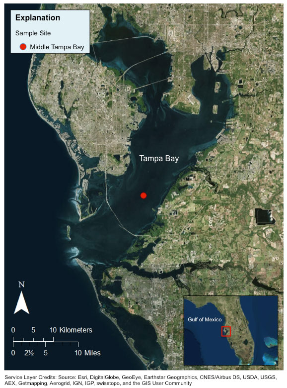
Figure 1. Location of OCSv2 data collection in Middle Tampa Bay (red circle) located at 27.66168° N 82.59470° W.
Suggested Citation
Yates, K.K., Moore, C.S., and Lemon, M.K., 2018, Time series of autonomous carbonate system parameter measurements in Middle Tampa Bay, Florida, USA (ver. 4.0, June 2022): U.S. Geological Survey data release, https://doi.org/10.5066/P9BAFC7L.
First posted April 04, 2018
Revised August 01, 2019, ver. 2.0
Revised March 11, 2021, ver. 3.0
Revised June 7, 2022, ver. 4.0