In accordance with SO #3423 - The Gulf of America and SO #3424 - Mount McKinley and Landmarks Honoring the Alaskan People, new USGS data releases specific to those named places will utilize the new name Gulf of America and the restored name Mount McKinley. Per USGS practice, historical data will retain the name of the geographic features as they were known at the time the data were originally released.
Data Release
Coastal Single-beam Bathymetry Data Collected in 2022 off Seven Mile Island, New Jersey
By Erin O. Lyons,1 Nancy T. DeWitt,2 Chelsea A. Stalk,2 Billy J. Reynolds,2 Andrew S. Farmer,2 Julie C. Bernier,2 Benjamin A. Galbraith,2 Emily A. Wei,2 and Jennifer L. Miselis2
1Cherokee Nations System Solutions
2U.S. Geological Survey, St. Petersburg Coastal and Marine Science Center
Summary
The U.S. Geological Survey St. Petersburg Coastal and Marine Science Center (USGS SPCMSC) collected single beam echosounder (SBES) data in the nearshore environment off Seven Mile Island, New Jersey in May 2022. This USGS data release includes the processed elevation point data (xyz) for Field Activity Number (FAN) 2022-309-FA, SubFAN 22BIM03 on board the research vessel (RV) Sallenger and SubFAN 22BIM05 on board the personal watercraft (PWC) RV Chum. Efforts were supported by the National Fish and Wildlife Foundation (NFWF) Beach and Marsh Monitoring Project and the USGS Coastal Sediment Availability and Flux (CSAF) Project. These projects aim to assess sediment availability and exchange in nearshore environments and incorporate shoreface morphology and geology into coastal-change assessments and predictions. The XYZ data are provided in three datums; the World Geodetic System of 1984 (WGS84) realization G2139 and the North American Datum 1983 (NAD83) for the horizontal and the North American Vertical Datum 1988 (NAVD88) with respect to GEOID18 and GEOID12B for the vertical. For further information regarding data collection and/or processing please see the metadata associated with this data release.
Data
| File Name and Description | Metadata (XML format) | Metadata (text format) | Download File |
|---|---|---|---|
| Seven_Mile_Island_2022_SBES_ WGS84_UTM18N_xyz.zip Single-beam bathymetry data points (xyz) in WGS84 (G2139) UTM18N ellipsoid (.csv) |
Seven_Mile_Island_2022_SBES_ WGS84_UTM18N_xyz_metadata.xml |
Seven_Mile_Island_2022_SBES_ WGS84_UTM18N_xyz_metadata.txt |
Seven_Mile_Island_2022_SBES_ WGS84_UTM18N_xyz.zip (31.7 MB) |
| Seven_Mile_Island_2022_SBES_ WGS84_UTM18N_tracklines.zip Single-beam bathymetry trackline shapefile in WGS84 (G2139) UTM18N (.shp) |
Same as above | Same as above | Seven_Mile_Island_2022_SBES_ WGS84_UTM18N_tracklines.zip (14.8 MB) |
| Seven_Mile_Island_2022_SBES_NAD83_ NAVD88_UTM18N_GEOID18_xyz.zip Single-beam bathymetry data points (xyz) in NAD83 and NAVD88 (orthometric height) with respect to the GEOID18 model (.csv) |
Same as above | Same as above | Seven_Mile_Island_2022_SBES_ NAD83_NAVD88_UTM18N_GEOID18_xyz.zip (31.9 MB) |
| Seven_Mile_Island_2022_SBES_NAD83_ NAVD88_UTM18N_GEOID12B_xyz.zip Single-beam bathymetry data points (xyz) in NAD83 and NAVD88 (orthometric height) with respect to the GEOID18 model (.csv) |
Same as above | Same as above | Seven_Mile_Island_2022_SBES_ NAD83_NAVD88_UTM18N_GEOID12B_xyz.zip (31.7 MB) |
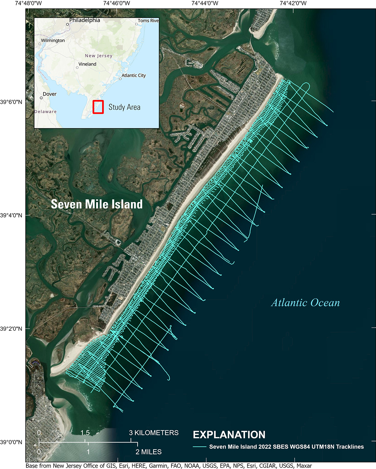
Figure 1. Location map for the coastal single-beam bathymetry collected in 2022 nearshore off Seven Mile Island, New Jersey. The single-beam survey is represented by the cyan-colored tracklines.
Suggested Citation
Lyons, E.O., DeWitt, N.T., Stalk, C.A., Reynolds, B.J., Farmer, A.S., Bernier, J.C., Galbraith, B.A., Wei, E.A., and Miselis, J.L., 2023, Coastal Single-beam bathymetry data collected in 2022 off Seven Mile Island, New Jersey: U.S. Geological Survey data release, https://doi.org/10.5066/P9P07T3W.