In accordance with SO #3423 - The Gulf of America and SO #3424 - Mount McKinley and Landmarks Honoring the Alaskan People, new USGS data releases specific to those named places will utilize the new name Gulf of America and the restored name Mount McKinley. Per USGS practice, historical data will retain the name of the geographic features as they were known at the time the data were originally released.
Data Release
Archive of Chirp Subbottom Profile Data Collected in 2015 From Dauphin Island, Alabama
By Arnell S. Forde,1 James G. Flocks,1 and Stanley D. Locker 2
1 USGS, St. Petersburg, Florida
2 Formerly USGS
Summary
As part of the Alabama Barrier Island Restoration Feasibility Study, scientists from the U.S. Geological Survey (USGS) St. Petersburg Coastal and Marine Science Center (SPCMSC) conducted a nearshore geophysical survey to map the shoreface and determine Holocene stratigraphy near Dauphin Island, Alabama (AL) in September of 2015. The objective of the project is to investigate nearshore geologic controls on surface morphology. Collecting geophysical data can help researchers to identify relationships between the geologic history of the island, its present-day morphology, and sediment distribution. High-resolution geophysical data collected along this barrier island can further the analyses and geomorphological interpretations of this and other coastal systems, improving researchers understanding of coastal response and evolution.
This data release serves as an archive of subbottom profile and navigation data collected September 16–23, 2015, offshore of Dauphin Island, AL, during USGS Field Activity Number 2015-330-FA. Data products, including chirp subbottom profile data and images, survey trackline maps, location data with formal Federal Geographic Data Committee (FGDC) metadata, and field logs are provided.
Data
| File Name and Description | Metadata (XML format) | Metadata (text format) | Download File |
|---|---|---|---|
| 2015-330-FA_segy.zip Digital chirp subbottom trace data (.sgy) |
2015-330-FA_metadata.xml | 2015-330-FA_metadata.txt | 2015-330-FA_segy.zip (2.21 GB) |
| 2015-330-FA_nav.zip Navigation data for the entire survey, 1000-shot-interval locations, and start of line locations (.csv) |
Same as above | Same as above | 2015-330-FA_nav.zip (4.8 MB) |
| 2015-330-FA_seisimag.zip Processed subbottom profile images (.gif) |
Same as above | Same as above | 2015-330-FA_seisimag.zip (110.2 MB) |
| 2015-330-FA_gis.zip Subbottom profile data location map, geospatial files, and images (.mxd, .kmz, .shp, .gif) |
2015-330-FA_shots.shp.xml 2015-330-FA_sol.shp.xml 2015-330-FA_trkln.shp.xml |
2015-330-FA_shots_metadata.txt 2015-330-FA_sol_metadata.txt 2015-330-FA_trkln_metadata.txt |
2015-330-FA_gis.zip (113.1 MB) |
| Supplemental information | |||
| 2015-330-FA_logs.zip Field Activity Collection System (FACS) logs and acquisition geometry (.docx, .tif) |
Not applicable | Not applicable | 2015-330-FA_logs.zip (117 KB) |
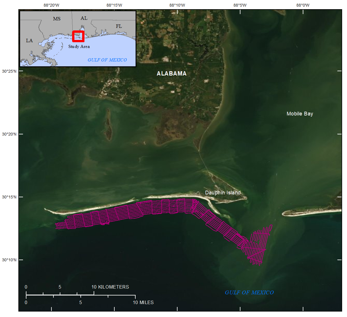
Figure 1. Regional map showing September 2015 Dauphin Island, Alabama study area (indicated by red box) and geophysical trackline locations.
Suggested Citation
Forde, A.S., Flocks, J.G., and Locker, S.D., 2022, Archive of chirp subbottom profile data collected in 2015 from Dauphin Island, Alabama: U.S. Geological Survey data release, https://doi.org/10.5066/P9YTIG6G.