In accordance with SO #3423 - The Gulf of America and SO #3424 - Mount McKinley and Landmarks Honoring the Alaskan People, new USGS data releases specific to those named places will utilize the new name Gulf of America and the restored name Mount McKinley. Per USGS practice, historical data will retain the name of the geographic features as they were known at the time the data were originally released.
Data Release
ATRIS Seafloor Images—West Turtle Shoal Patch Reef, Rawa Patch Reef, Dustan Rocks Patch Reef, and Thor Patch Reef, Florida, 2011
By David G. Zawada,1 Rob Ruzicka,2 Michael A. Colella,2 and Jessica P. Resnick3
1U.S. Geological Survey, 600 4th Street South, St. Petersburg, FL 337012 Fish & Wildlife Research Institute, Florida Fish and Wildlife Conservation Commission, 100 8th Ave SE St. Petersburg, FL 33701
3Cherokee Nation Technologies, U.S. Geological Survey, 600 4th Street South, St. Petersburg, FL 33701
Summary
The U.S. Geological Survey St. Petersburg Coastal and Marine Science Center developed the Along-Track Reef Imaging System (ATRIS) in order to capture high-resolution, geo-located images of the seafloor. The images in this data release were collected September 29–30, 2011 at West Turtle Shoal, Rawa, Dustan Rocks, and Thor patch reefs near Marathon, Florida. The transects below show the path of image collection.
For further information regarding data collection methods, refer to:
Zawada, D.Z., Ruzicka, R., and Colella. M.A., 2015, A comparison between boat-based and diver-based methods for quantifying coral bleaching: Journal of Experimental Marine Biology and Ecology, v. 467, p. 39–44, https://doi.org/10.1016/j.jembe.2015.02.017.
Data
| File Name and Description | Metadata (XML format) | Metadata (text format) | Download File |
|---|---|---|---|
| FRRP2011_ATRIS_Track1.zip JPEG images with EXIF headers collected using shallow ATRIS at West Turtle Shoal Patch Reef, Florida (.jpg) |
FRRP2011_ATRIS_metadata.xml | FRRP2011_ATRIS_metadata.txt | FRRP2011_ATRIS_Track1.zip (54 MB) |
| FRRP2011_ATRIS_Track2.zip JPEG images with EXIF headers collected using shallow ATRIS at Rawa Patch Reef, Florida (.jpg) |
Same as above | Same as above | FRRP2011_ATRIS_Track2.zip (34 MB) |
| FRRP2011_ATRIS_Track3.zip JPEG images with EXIF headers collected using shallow ATRIS at Dustan Rocks Patch Reef, Florida (.jpg) |
Same as above | Same as above | FRRP2011_ATRIS_Track3.zip (34 MB) |
| FRRP2011_ATRIS_Track4.zip JPEG images with EXIF headers collected using shallow ATRIS at Thor Patch Reef, Florida (.jpg) |
Same as above | Same as above | FRRP2011_ATRIS_Track4.zip (84 MB) |
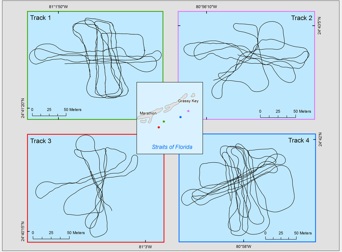
Figure 1. ATRIS image extent for the for sites; data were collected in September 2011.
Suggested Citation
Zawada, D.G., Ruzicka, R., Colella, M.A., Resnick, J.P., 2016, ATRIS Seafloor Images—West Turtle Shoal Patch Reef, Rawa Patch Reef, Dustan Rocks Patch Reef, and Thor Patch Reef, Florida, 2011: U.S. Geological Survey data release, https://doi.org/10.5066/F73N21H0.