In accordance with SO #3423 - The Gulf of America and SO #3424 - Mount McKinley and Landmarks Honoring the Alaskan People, new USGS data releases specific to those named places will utilize the new name Gulf of America and the restored name Mount McKinley. Per USGS practice, historical data will retain the name of the geographic features as they were known at the time the data were originally released.
Data Release
Sediment and Radiochemical Characteristics from Shore-Perpendicular Estuarine and Marsh Transects in the Grand Bay National Estuarine Research Reserve, Mississippi
By Alisha M. Ellis,1 Christopher G. Smith,1 Joseph M. Vargas,2 and Cheyenne S. Everhart1
1St. Petersburg Coastal and Marine Science Center, U.S. Geological Survey
2Cherokee Nation System Solutions, contracted to U.S. Geological Survey
Summary
To examine sediment transport and provenance between a marsh and estuary, surface sediments were collected along two transects in the Grand Bay National Estuarine Research Reserve, Mississippi (GNDNERR). Each shore-perpendicular transect consisted of fifteen surface samples, collected every 2.5 meters (m) from 10-m out into the estuary to 25-m into the marsh from the shoreline. Sediment samples were analyzed for their physical and radiochemical properties or signatures. Sediment samples were collected during U.S. Geological Survey field activity number (FAN) 2017-315-FA (alternate FAN, [altFAN] 17CCT02) in April 2017. Marsh and estuarine surface samples were collected as part of the St. Petersburg Coastal and Marine Science Center Estuarine-MaRsh Geology (EMRG) research project. Please read the full metadata for details on data collection, dataset variables, and data quality.
Data
| File Name and Description | Metadata (XML format) | Metadata (text format) | Download File |
|---|---|---|---|
| 17CCT02_Transect_SiteInfo.zip Location and elevation of transect surface samples (.csv, .xlsx) |
17CCT02_Transect_Metadata.xml | 17CCT02_Transect_Metadata.txt | 17CCT02_Transect_SiteInfo.zip (35 KB) |
| 17CCT02_Transect_Radiochemistry.zip Radiochemical properties for select sediment surface samples via gamma spectroscopy (.csv, .xlsx) |
Same as above | Same as above | 17CCT02_Transect_Radiochemistry.zip (35 KB) |
| 17CCT02_Transect_LOI.zip Loss-on-Ignition (LOI) data for organic matter content for the sediment surface samples (.csv, .xlsx) |
Same as above | Same as above | 17CCT02_Transect_LOI.zip (33 KB) |
| 17CCT02_Transect_GrainSize.zip Grain-size characteristics for the sediment surface samples (.csv, .xlsx, .pdf) |
Same as above | Same as above | 17CCT02_Transect_GrainSize.zip (258 KB) |
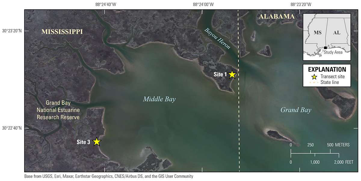
Figure 1. Location of the two sites within the Grand Bay National Estuarine Research Reserve in Mississippi where the shore-perpendicular transects were collected.
Suggested Citation
Ellis, A.M., Smith, C.G., Vargas, J.M., and Everhart, C.S., 2022, Sediment and radiochemical characteristics from a shore perpendicular estuarine and marsh transect in the Grand Bay National Estuarine Research Reserve, Mississippi: U.S. Geological Survey data release, https://doi.org/10.5066/P9BLFW2G.