In accordance with SO #3423 - The Gulf of America and SO #3424 - Mount McKinley and Landmarks Honoring the Alaskan People, new USGS data releases specific to those named places will utilize the new name Gulf of America and the restored name Mount McKinley. Per USGS practice, historical data will retain the name of the geographic features as they were known at the time the data were originally released.
Data Release
Sr/Ca and Linear Extension Data for a Modern Orbicella faveolata Colony From Marquesas Keys, Florida, USA
By Jennifer A. Flannery,1 Julie N. Richey,2 Lauren T. Toth,2 and Madelyn J. Mette2
1 Cherokee Nation System Solutions contracted to the U.S. Geological Survey, St. Petersburg Coastal and Marine Science Center
2 U.S. Geological Survey, St. Petersburg Coastal and Marine Science Center
Summary
The coral Strontium/Calcium (Sr/Ca) paleothermometer can provide a powerful proxy for centennial-scale sea-surface temperature (SST) variability in the Caribbean/Atlantic Ocean region. This data release presents a new, 150-year proxy reconstruction (1830-1980 C.E.) of monthly-resolved Sr/Ca-based SST estimates from the coral species Orbicella faveolata collected from the Marquesas Keys, Florida (FL), USA in 1980. The reconstruction shows pronounced decadal-scale variability with a range of 1 to 2 °Celsius (C). The coolest portion of the Sr/Ca-SST record coincides with the end of the Little Ice Age. Following the Little Ice Age, there was a trend of significant winter warming to present. Strong coherence among coral-based SST reconstructions in the Caribbean-Atlantic over the past century suggests a common driver of multidecadal SST trends throughout the region. Significant relationships occur between the Sr/Ca-SST record and Atlantic Multidecadal Variability. For further information regarding data collection and/or processing methods, refer to the associated journal article (Flannery and others, 2024).
Flannery, J.A., Richey, J.N., Toth, L.T., and Mette, M.J., 2024, 20th century warming in the western Florida Keys was dominated by increasing winter temperature: Paleoceanography and Paleoclimatology v. 39, no. 2, p. 1-16, https://doi.org/10.1029/2023PA004748.
Data
| File Name and Description | Metadata (XML format) | Metadata (text format) | Download File |
|---|---|---|---|
| MK1_Sr_Ca_LER_1830_1980.zip Sr/Ca and linear extension rates for an O. faveolata colony (.csv, .xlsx) |
MK1_Sr_Ca_LER_ 1830_1980_metadata.xml |
MK1_Sr_Ca_LER_ 1830_1980_metadata.txt |
MK1_Sr_Ca_LER_1830_1980.zip (128 KB) |
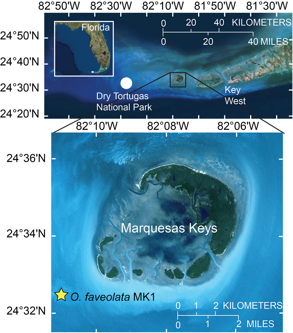
Figure 1. Map of the Marquesas Keys, Florida Keys, USA. Yellow star represents the coral colony of Orbicella faveolata used in this study, collected in August 1980. Inset: Map of the state of Florida, USA with the Marquesas Keys in a black rectangle. The red dot represents the location of the Dry Tortugas National Park and its proximity to the Marquesas Keys and Key West. Base from Esri, DigitalGlobe, GeoEye, Earthstar Geographics, CNES/Airbus DS, USDA, AeroGRID, IGN, and the GIS User Community.
Suggested Citation
Flannery, J.A., Richey, J.N., Toth, L.T., and Mette, M.J., 2023, Sr/Ca and linear extension data for a modern Orbicella faveolata colony from Marquesas Keys, Florida, USA: U.S. Geological Survey data release, https://doi.org/10.5066/P9Q01QJJ.