In accordance with SO #3423 - The Gulf of America and SO #3424 - Mount McKinley and Landmarks Honoring the Alaskan People, new USGS data releases specific to those named places will utilize the new name Gulf of America and the restored name Mount McKinley. Per USGS practice, historical data will retain the name of the geographic features as they were known at the time the data were originally released.
Data Release
Archive of Chirp Subbottom Profile Data Collected in June 2018 From Fire Island, New York
By Arnell S. Forde, Nancy T. DeWitt, Jake J. Fredericks, and Jennifer L. Miselis
USGS, St. Petersburg, Florida
Summary
Researchers from the U.S. Geological Survey (USGS) conducted a long-term, coastal morphologic-change study at Fire Island, New York, prior to and after Hurricane Sandy impacted the area in October 2012. The Fire Island Coastal System Change project objectives include understanding the morphologic evolution of the barrier island system on a variety of time scales (months to centuries) and resolving storm-related impacts, post-storm beach response, and recovery. In June 2018, scientists from the USGS St. Petersburg Coastal and Marine Science Center conducted geophysical surveys on Fire Island to characterize and quantify spatial variability in the subaerial geology with the goal of subsequently integrating onshore geology with other shoreface datasets also collected under the Disaster Relief Appropriations Act of 2013, using the U.S. Department of the Interior Hurricane Sandy supplemental funding.
This data release serves as an archive of high-resolution subbottom profiles and differential global positioning system (DGPS) navigation data collected from beach and nearshore environments on Fire Island, June 2–16, 2018 (USGS Field Activity Number 2018-322-FA). USGS scientists created a purpose-built, towed sled system to mount the chirp profiler (just below the water’s surface) and enable launching and recovery from the foreshore. The seismic sled was also configured to help ensure the quality of data collected in exceedingly shallow water depths, such as those observed near the shoreline and surf zone. For additional information regarding data acquisition and processing methods, refer to the metadata.
Data
| File Name and Description | Metadata (XML format) | Metadata (text format) | Download File |
|---|---|---|---|
| 2018-322-FA_seisimag.zip Processed subbottom profile images (.gif) |
2018-322-FA_metadata.xml | 2018-322-FA_metadata.txt | 2018-322-FA_seisimag.zip (54.1 MB) |
| 2018-322-FA_nav.zip Survey navigation data (.txt) |
Same as above | Same as above | 2018-322-FA_nav.zip (8.8 MB) |
| 2018-322-FA_arc.zip Survey trackline locations (.mxd, .kml, .shp) |
Same as above | Same as above | 2018-322-FA_arc.zip (58.6 MB) |
| Supplemental information | |||
| 2018-322-FA_logs.zip Field Activity Collection System (FACS), acquisition geometry and geophysical operations logs (.docx, .xlsx) |
Not applicable | Not applicable | 2018-322-FA_logs.zip (178 KB) |
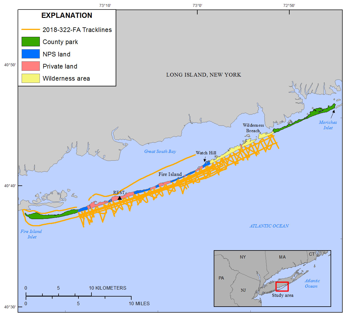
Figure 1. Regional map showing the June 2018 survey area (indicated by red box) and trackline locations. Basemap modified from New York State Office of Information Technology GIS Program Office 1:24,000 scale.
Suggested Citation
Forde, A.S., DeWitt, N.T., Fredericks, J.J., and Miselis, J.L., 2019, Archive of chirp subbottom profile data collected in June 2018 from Fire Island, New York: U.S. Geological Survey data release, https://doi.org/10.5066/P9Q8TVHH.